LOCATION: SOUTH KAWARTHAS
ROUTE DISTANCE: 50KM
COMPLETION TIME: 3-4H
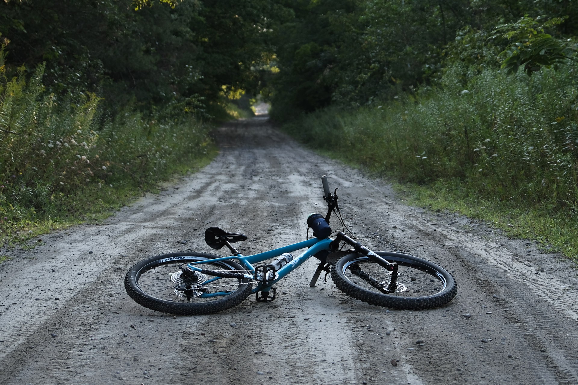
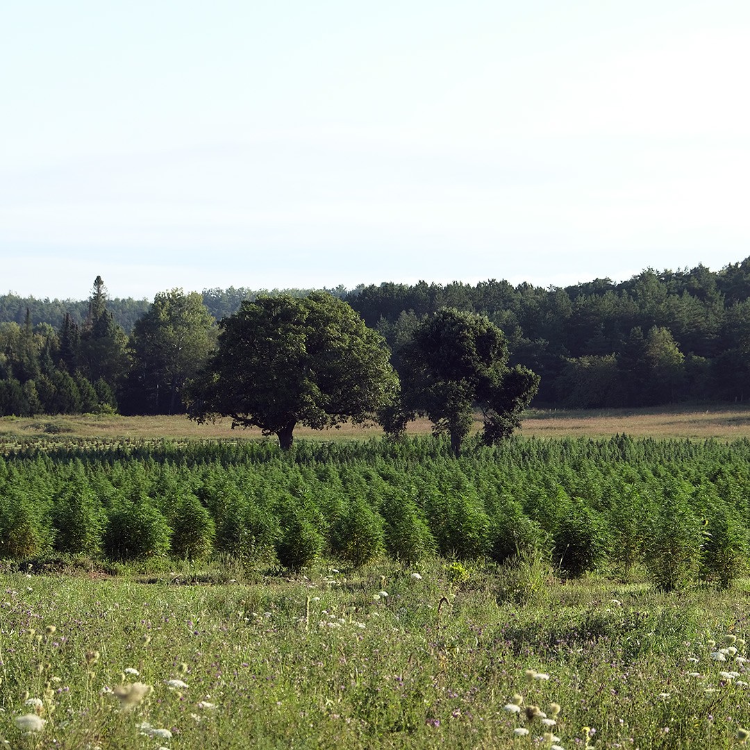
Slay the Gray route is a mixed-surface ride that will take you along paved, gravel, and dirt roads in the South Kawartha region. The route passes many rural farms and wooded conservation areas, offering several climbs with great views of the Kawartha region. Despite its somewhat short 50km length, the technical attributes make it feel slightly longer. If you wish to extend this ride, there are many offshoots to explore. A mountain bike is best suited for this ride; however, a drop bar bike with tires greater than 40mm could also work, but you may need to hike-a-bike some sections, which significantly adds to the challenge. This is truly an all-terrain bike route, so be prepared for anything and everything. It is not beginner-friendly and is better suited to intermediate to advanced riders.
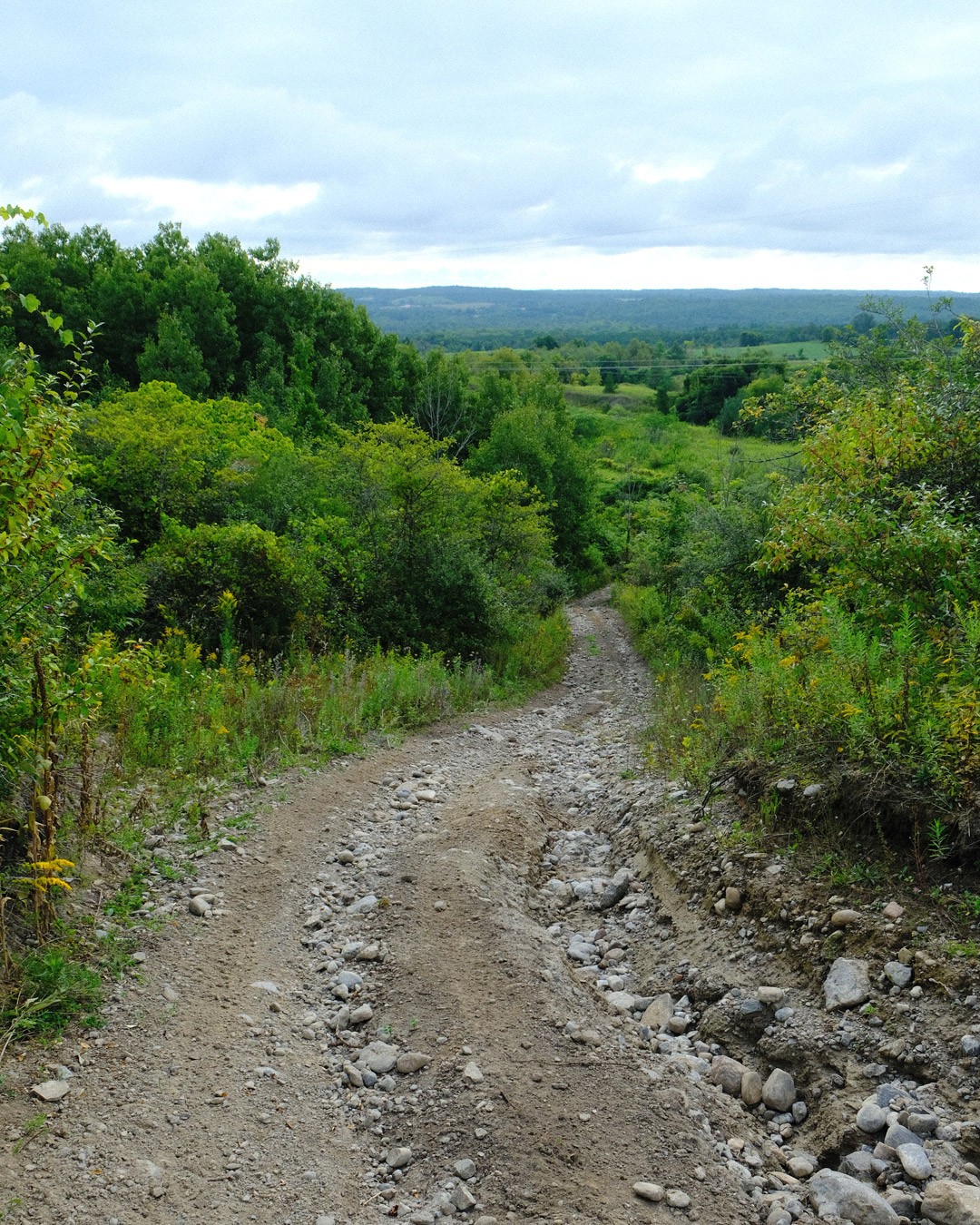
The ride starts near Boundary Road, known for its challenging sandy surface. It would be wise to bring a bike with fatter tires to complete this section and the ones that follow. After exiting Boundary Road, you will head north to Gray Road, then travel east. The road varies from a small paved section to mostly gravel, then to an unmaintained ATV trail with steep, punchy climbs, ruts, and baby heads.
Exiting Gray, you will head south to Porter Road, then start your trip west along Ballyduff Road. The road deteriorates quickly, with larger tires proving to be best suited. You will not spend too much time on Ballyduff, shortly heading south along Solanum Way. You will then make your way west via Telecom Rd. and Sandy Hook Rd. If you would like to stop for food, detouring into the town of Pontypool may be an option at this point, though it is possibly a few kilometers away.
The last portion of this ride, which takes you along Sandy Hook Rd., lives up to its name; there will be sandy portions that are better suited to fatter tires. Shortly after Sandy Hook, you will return to the start via Long Sault Conservation.


OFFSHOOTS
Because this ride passes through several conservation areas, you will have the option to explore further.
Long Sault Conservation: A popular multiuse forest, but due to higher use, you will need to be more aware of your surroundings. It provides approximately 18km of trail.
Durham East Cross Forest: Situated along Boundary Road, it has approximately 7km of trail and appears to be less busy compared to Long Sault. There is a Porto-potty inside the parking lot, which can be handy.
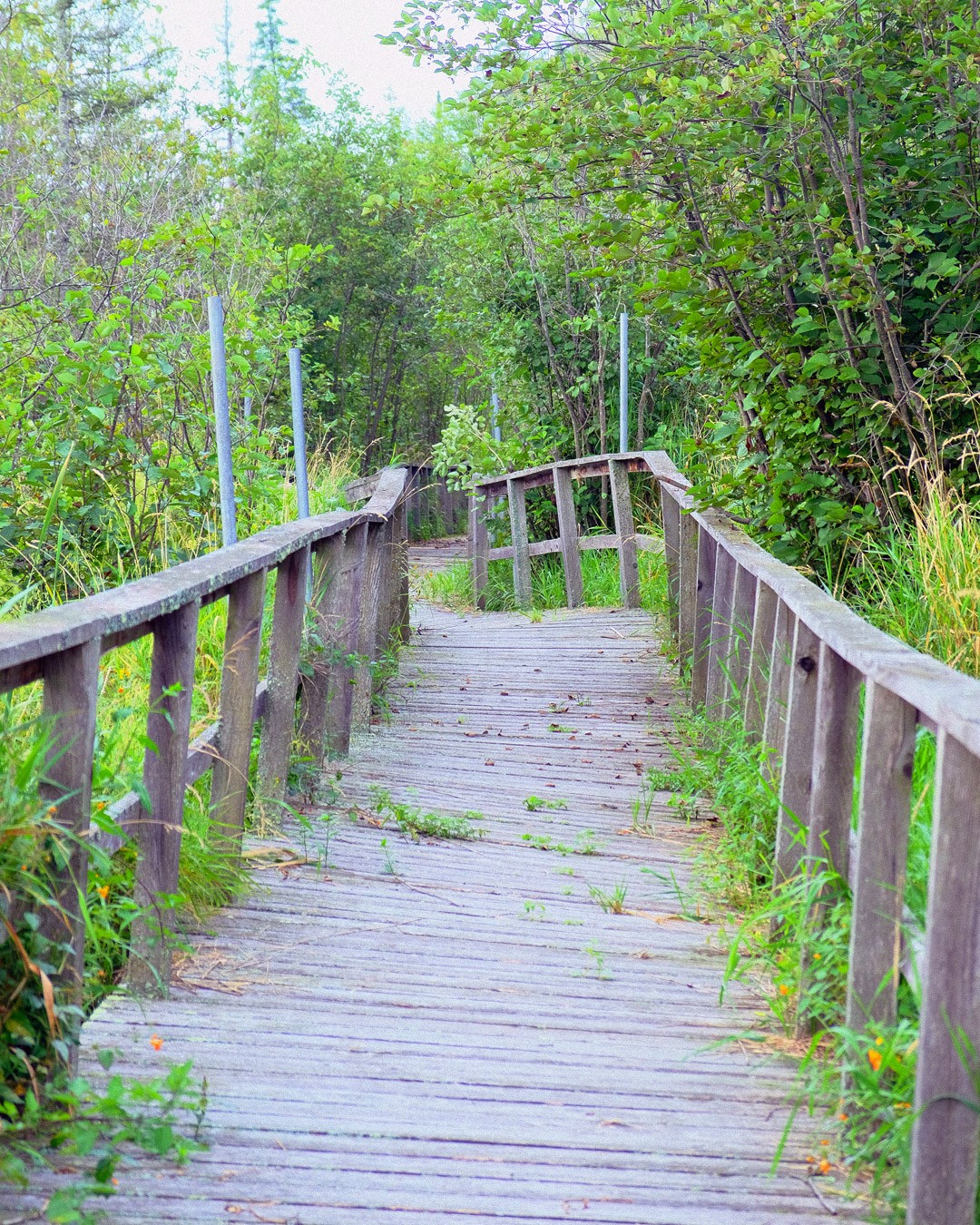
Pigeon River Conservation: This conservation area is slightly more remote, so you will be less likely to bump into other users. It offers a few kilometers of trail and is part of the Slay The Gray route. The park offers an interesting wooden boardwalk worth checking out.
Fleetwood Conservation: It is also harder to access, so it tends to be quiet. It has a few kilometers of trail to explore with a lookout deck that provides a great view of the surrounding area.
CHALLENGES
TIRE CHOICE:
This route can be challenging depending on the type of bike you’re riding and the weather conditions on the day of or leading up to your ride. Many sections of the route are prone to flooding and can be blocked by pools of water. They are typically easy to maneuver around, but consider postponing your trip if it has rained the day or days before. Also, be aware that due to the many sandy sections, if it has been particularly dry, it will be very loose and slow-going in parts. If your bike has skinny tires, you will not be able to complete many sections of this ride. There are sections of this route with larger boulders and rutted-out features that would make this ride harder on a drop bar bike or a bike with skinnier tires.
BUGS:
From May until September, you will also need to combat the bugs in this area. There are many wet sections that are a haven for mosquitoes. You will also encounter deer-fly and black-fly across the entire route (pro-tip maintain a speed above 20km/h … they'll have a harder time keeping-up with you). Avoid any long grass if possible, as ticks could also be a concern. Cover yourself up as much as possible and apply bug spray to reduce your chances of getting bitten by the various critters. Though unlikely, you may also encounter black bears within the conservation areas.
HAZARDS:
Because this route has many remote stretches, you will want to carry repair tools. It would be wise to carry a cell phone in case things go sideways. This tends to be a low-traffic area, and other than the paved roads you pass over, you are unlikely to come across too many travelers. There are several sections that could be hazardous if you hit a rut or boulder at speed, so be cautious at all times. Also, be aware that on the unmaintained roads, you may come across ATV or dirt bike riders traveling at higher speeds.
LACK OF RESUPPLY:
Also, be aware that there are no places to stop to buy food along this route. The only major town within the area is Pontypool, but it requires a larger detour. There are many streams along the route where you could filter water if you were in a jam. Be aware that private property abuts many of the conservation areas. Most will be signed, but it is best to stick to the route as much as possible.
Kawartha – Martha Whetung of the Curve Lake First Nations coined this name in 1895, and it meant "land of reflections" in the Anishinaabe language, as per Whetung DERIVED FROM KA WASA (KA = WATER, WASA = SHINING). Subsequently, tourism promoters altered the word to Kawartha, signifying "bright waters and happy lands."
How the Kawarthas were named
The starting point of this ride is located at Long Sault Conservation. Approximately 20 minutes north of Bowmanville.
Parking: There is free parking available near the conservation where Concesion Rd 10 turns into Avery Rd. Google Map Location
Public Transit: This route is not particularly transit friendly. It is located approx. 20km north of Bowmanville so options may exist.
Bring bug spray; Mosquitos and deerfly are bad in the summer.
Use a big with fatter tires. Ideally 2"+.
Some stretches are remote, bring repair kit.
Limited places to stop for food or drink (lots of streams to filter).
Rider Skill Level: Intermediate/Advanced
DOWNLOAD GPX
Terms of Use: Like all routes on Explore on Bike, if you decide to bike this route, do so at your own risk. Check current local weather, conditions, and closures before starting. Respect all land use rules, carry proper equipment, and follow the leave-no-trace principles This information is a planning resource, so do your own research. Despite careful preparation, we can't guarantee 100% accuracy or assume liability for injuries, property damage, or other issues that may occur while cycling this route.