LOCATION: PETERBOROUGH EAST
ROUTE DISTANCE: 90KM
COMPLETION TIME: 3-4H
First, let's get to this route's name: Rompin' Ronnie. If you haven’t made the connection yet, this area was where musician Ronnie Hawkins called home for many decades of his life. From some Google sleuthing, I was able to locate the property at Stony Lake. So that formed the main point of interest for this ride: find Ronnie's home and see what other stops could be made along the way.
The starting point for this ride is along the Otonabee River just north of Trent University. There are several water-lock parking lots you can use that appear to be free (I didn’t get a ticket after parking for several hours). And bonus there are some really nice washroom facilities to use here, either before or after your ride.
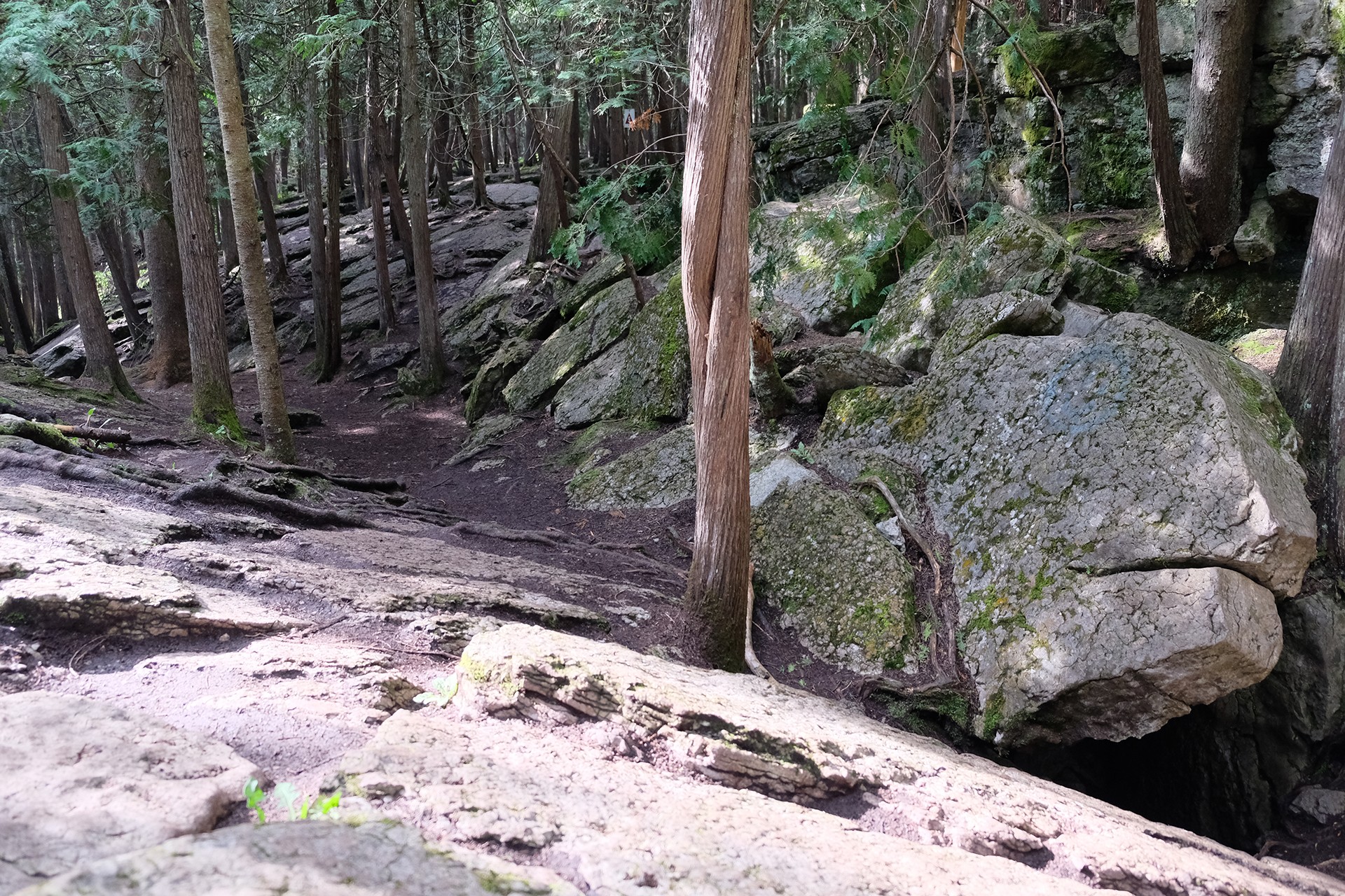
After departing the water lock, you will head east towards Warsaw. This portion of the ride will take you on some pretty tame gravel/farm roads along Centre Road. You will not enter the town of Warsaw; you will, however, pass by the Warsaw Conservation Area. It’s here that I recommend you take a detour and check out the caves. You will need to pay to gain access; it’s about $10 but well worth it. You could spend hours here, but my advice is to dip in for about a half-hour and experience the cave area. There are also some washrooms and a place to sit and have a snack.

After leaving the Warsaw Conservation Area, you will make your way over to the late Ronnie Hawkins' estate. This is obviously private property, so stay on the road, but it’s quite interesting to think about all the music talent that made their way over here to spend time with Ronnie. The view from Hawkins Lane looking on to Stony lake is pretty special.
Departing the Hawkins estate, you will now make your way east again along County Road 6. From here on out, most of the journey is paved. This road lacks any decent shoulder to ride on, so you will be in close contact with passing cars. For the most part, there is very little reason to stop along this section of the ride. There is an interesting abandoned settler house can make for a nice photo, but for the most part, it’s a pretty sterile stretch. Once you pass the Log Cabin Store (which might offer some food options), you will turn left onto Northeys Bay Road.
Like CR-6 this road too is quite narrow, but more closed in with dense trees on either side. The road provides some nice twisty turns, and there are a few decent pull-off points such as Eels Creek and access to some public areas of Stony Lake. You will also pass Petroglyphs Provincial Park, which provides another detour option that I have not taken but have heard great things about (an excellent opportunity to learn more about the First Nations people of this area).
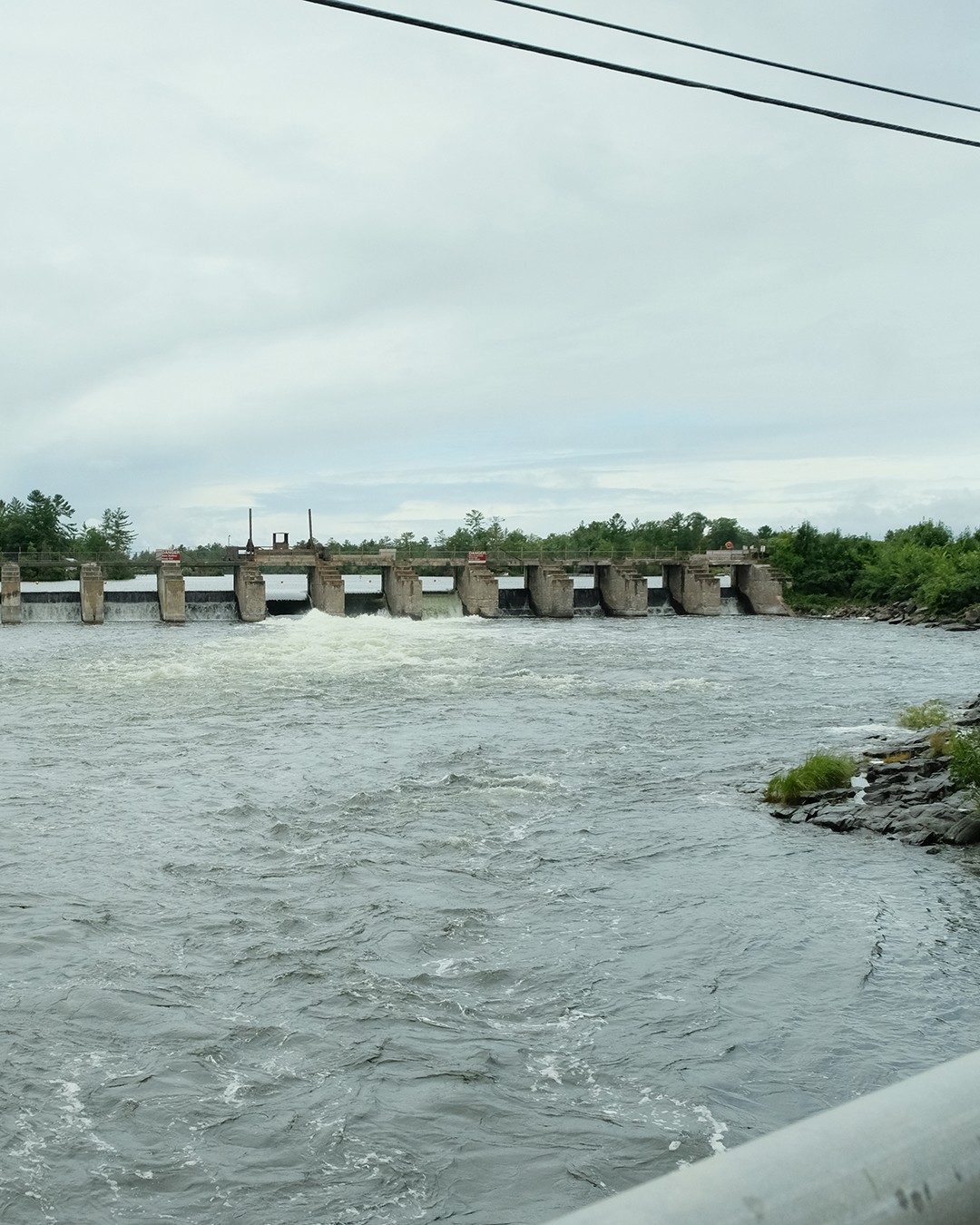
You will stick on Northeys Bay Road, turning onto Reid, making your way to County Road 28. Once you reach this point, you will swing left and ride along here for a significant part of the journey back. The road is very busy during the summer months; however, the wide shoulder makes it quite protected for cyclists. Stopping in Burleigh Falls to check out the water feature is recommended. The end of this ride is fast approaching; you will pass through Lakefield (not a bad option if you’re getting hungry) then back to the start at Lock 24.


OFFSHOOTS
Because this ride passes through several conservation areas you will have the option to explore further.
Warsaw Caves: situated in the Warsaw Caves Conservation Area near the village of Warsaw, Ontario, Canada, are a collection of caverns with lengthy passages and predominantly small open areas, making them accessible to spelunkers. Not bike friendly so if you're exploring the area on foot lock up your bike.
Petroglyph Park: It has the largest collection of ancient First Nations petroglyphs (rock carvings) in Ontario. "The carvings were created in the pre-Columbian era and represents aspects of First Nations spirituality, including images of shamans, animals, reptiles, and, possibly, the Great Spirit itself." Again this place is to be experienced on foot, so bring a bike lock

RONNIE HAWKINS 3 RANDOM THINGS
1• Ronnie Hawkins was an avid collector of antique furniture and owned a shop in Peterborough, Ontario, where he sold his finds.
2• He once owned a nightclub in Toronto called The Hawk's Nest, which was a popular hangout for musicians and celebrities in the 1970s.
3• Hawkins was a mentor to many Canadian musicians, including Gordon Lightfoot and David Foster, who credit him with helping launch their careers.
CHALLENGES
TRAFFIC:
The main roads of this route such as County Road 6, and County Road 28 get extremly busin in the summer. CR-6 has almost zero shoulder so you will be riding very close to cars traveling at high rates of speed. For the most part the drivers are courteous and give space but you will get some Jerks. CR-28 is even busier however there is a decent shoulder to ride on. This route will be safer when riding with other people, or at least were highly visible clothing and lights on your bike.
BUGS:
If you decide to enter the Warsaw Conservation area bring bug spray with your or cover up. Due to the damp conditions you will encounter hungry mosquitos. There are also tick warnings but in my opinion less of a concern this far north.
LACK OF RESUPPLY:
This area is some-what limited in terms of places to stop for food or drink especially for the first 40km. Just keep that in mind.
The starting point of this ride is located at Long Trent-Severn Waterway Lock 24. Approx. 10 minutes north-east of Peterborough.
Parking: You can park at one of the Waterway Locks such as No.24. It could get busy on a summer weekend. Google Map Location
Public Transit: This route is not particularly transit friendly.
Some of the paved roads in this area a quite narrow with blind bends, be cautious of passing cars.
There are limited food and drink options along this route.
Rider Skill Level: Beginner
DOWNLOAD GPX
Terms of Use: Like all routes on Explore on Bike, if you decide to bike this route, do so at your own risk. Check current local weather, conditions, and closures before starting. Respect all land use rules, carry proper equipment, and follow the leave-no-trace principles This information is a planning resource, so do your own research. Despite careful preparation, we can't guarantee 100% accuracy or assume liability for injuries, property damage, or other issues that may occur while cycling this route.